We recently had the opportunity to deliver on a month-long ground penetrating radar survey of utilities for a renewable energy solar farm project in Exeter.
Ground-penetrating radar (GPR) is a geophysical technique that uses radar pulses to image the subsurface, and is often used by underground surveyors to identify buried objects, such as pipes, cables, and archaeological artifacts.
As this renewables project involves a lot of ground mount piles to be installed as the project progressed; our first week was spent establishing Primary Controls and producing accurate topographical surveys of each field so as to ensure that any anomalies picked up would be accurately positioned to Ordnance Survey OSGB36 Grid.
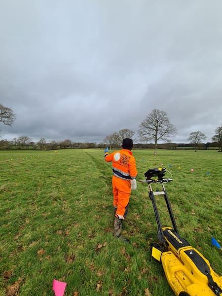
Once complete, our topographical survey was followed by the establishment of multiple local grids in order to segment the fields for GPR scanning. This allowed us to maintain an accurate and precise GPR survey of any below ground utilities discovered. These grids were marked out using flags, measuring tapes, and a bit of Pythagoras theorem, for our series of 200m by 15m grids; and were marked at 1m intervals using matching flags at each end.
We were then able to scan the fields by moving the GPR antenna along the survey lines marked. We made sure to maintain a consistent speed and direction, adjusting the height of the antenna when required to maintain a consistent depth of penetration. Throughout this project we were faced with both extreme weather and ground condition challenges, both of these factors can often influence the accuracy of the data being scanned. On this project, our risk management procedures were very helpful because we were able to both manually operate the ground penetrating radar and still use alternative methods to minimise manual effort; meaning that we were able to still deliver our work on time.
As soon as we finished a particular GPR survey grid as marked on the field, we uploaded the data to the cloud where one of our colleagues in London were able to process our scans in near real-time. Processing the data enabled our colleagues back in the office to create an image of the subsurface and involved filtering and stacking the data to remove noise and enhance the signal. During our survey we managed to discover a number of land drains, water pipes and manholes as important information to pass on to the client in order to help design the solar panels around these existing services.
Overall, this was a complex and time-consuming project, but with careful planning and the right equipment, we were able to provide valuable information about the subsurface to our client in good time.
Written by Engin Kaya
Edited by Olivia
For more about our GPR scanning services feel free to call us on 02072780778 where a member of our team will be happy to help.